55. Grenada 2003 - Tourist Map - Capital of St. George's
This Map Shows the City of St. George's
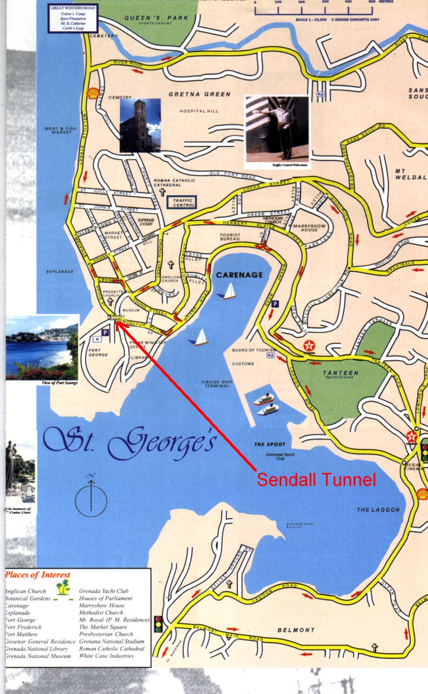
Previous | Home | NextThe map shows the Capitol City of St. George's, including the inner Harbor which is called "The Carenage". The truck ride back to Gouyave from Supply at Salines went right around this part of the harbor, on Warf Road, then onto Monkton/Battery Street and through the 12-foot-high, 340-foot-long Sendall Tunnel, named after the governor in office at the time of its construction in 1895
(Click on the map for a larger view.)